South Island has a landscape of temperate forests and Garry Oak ecosystems with a variety of outdoor recreation options- like hiking, mountain biking, and wandering. There are many kilometres worth of trails.
For quick nature spots, you can check out the Capital Regional District website, All Trails, or just Google Maps to see what’s near you.
Thing is, many of these trails and parks are fragmented. The Galloping Goose is a great example of a long-distance nature trail that benefits the surrounding communities. Here at NTS, the overarching idea is that connected trails are apart of smart planning and healthy communities, so it’s a good thing to sanction connections between trails/parks.
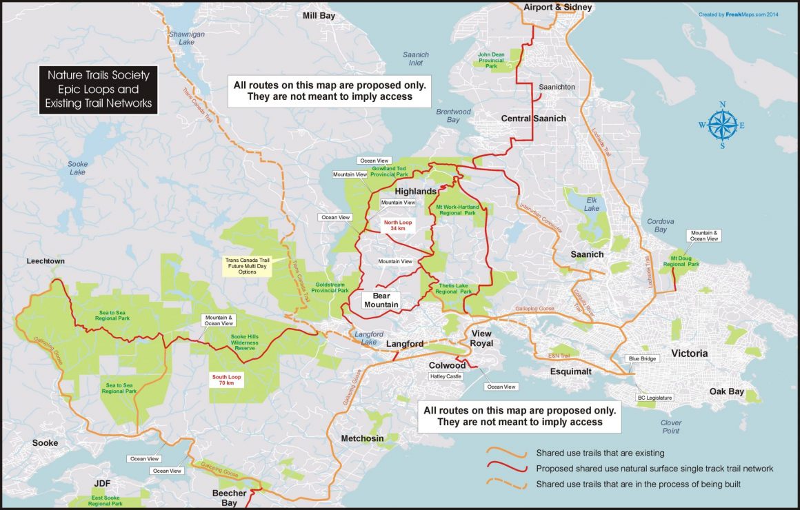
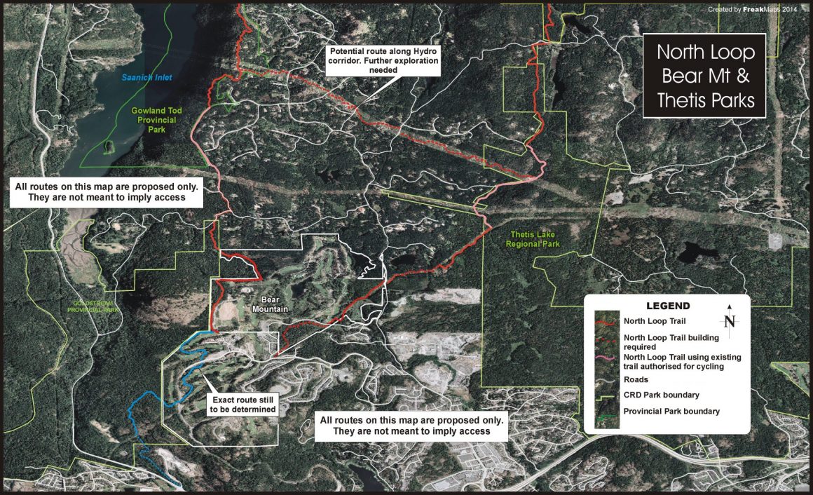
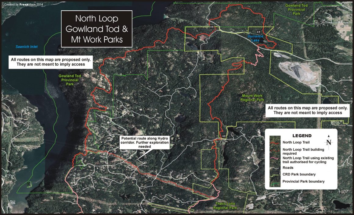
The following maps were created by the Executive Director to demonstrate examples of potential long-distance trails and loops. Please note that these maps are not meant to suggest that these are all active trails- but that they indicate areas that could be further investigated for their feasibility since there appears to be potential for users. If there was a great demand to increase hiking and mountain biking options in the CRD, these are some routes to consider making official.
Maps of Proposed Routes
Multi-Jurisdictional EPIC Loop and Networks
The benefits of this connected trail network are vast: increased visitation to our parks, healthier communities, increased variety of trails to enjoy for all, more connected communities, environmental stewardship, international recognition as an outdoor adventure destination and economic development opportunities for businesses close to the network.
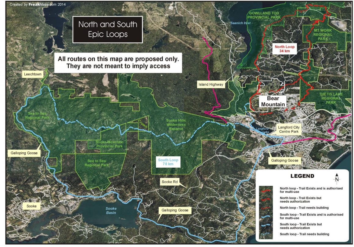
North and South Epic Loops in the Westshore Area
One of the primary objectives is to connect, authorize, upgrade, sign and maintain two large epic loops in the region. One that is proposed to travel through the Gowlland Tod Provincial Park into the Hartland – Mt. Work Regional Park, then into the Thetis Lake Regional Park to connect back together in the Langford area.
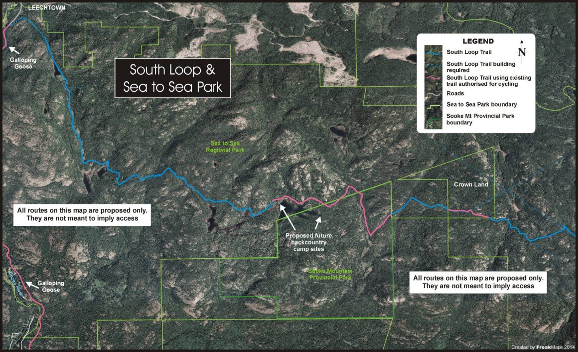
The second loop is much larger and would travel from Langford through the Sooke Hills to Leechtown and back using the Galloping Goose trail.
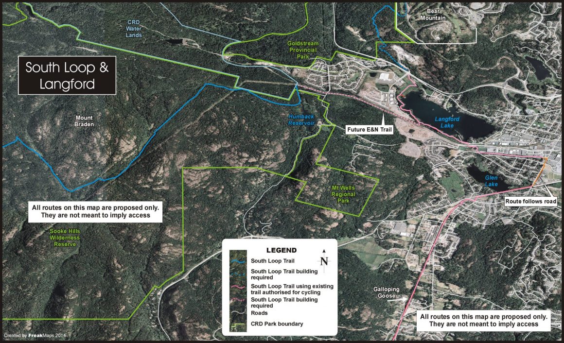
South Loop and Langford
The South Loop is proposed to travel down Bear Mt. and cross the Trans Canada highway at the West Shore Parkway.
Then travel around Langford lake on the Ed Nixon Trail, which is already shared use.
